Public Reports
Air & Water Database Public Reports
Public Reports
Air & Water Database Public Reports
SCAN Site:
Hayford Peak
State:
Nevada
Site Number:
2143
County:
Clark
Latitude:
36 deg; 39 min N
Longitude:
115 deg; 12 min W
Elevation:
9870 feet
Reporting since:
2007-10-26
Discontinued:
2018-05-22
Questions about this site.
Site notes:
Data is provisional and subject to revision.
More site notes.
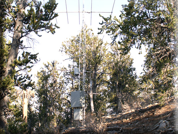
Photograph is of the Hayford Peak SCAN site.
2023-November-30 National Water and Climate Center
Check to view temperatures in degrees Fahrenheit. Default is degrees Celsius.
Select Report Content
Select Time Series
Select Format
Standard SCAN (no chart) ( 2007-10-26)
All Sensors (no chart)
Soil Moisture & Temperature (2007-10-26)
Soil Moisture (2007-10-26)
Soil & Air Temperature (2007-10-26)
Precipitation 2007-10-26
Atmospheric 2007-10-26
Wind (
2007-10-26
)
Solar (
2007-10-26
)
===Individual elements===
Air Temperature (
2007-10-26
)
Dew Point Temperature (
2007-10-26
)
Precipitation Accumulation (
2007-10-26
)
Precipitation Increment (
2007-10-26
)
Relative Humidity (
2007-10-26
)
Relative Humidity Enclosure (
2007-10-26
)
Snow Depth (
2007-10-26
)
Soil Moisture Percent (
2007-10-26
)
Soil Temperature (
2007-10-26
)
Solar Radiation - Accumulated (
2015-07-31
)
Solar Radiation - Net (
2007-10-26
)
Solar Radiation - Total (
2007-10-26
)
Vapor Pressure - Partial (
2008-08-13
)
Vapor Pressure - Saturated (
2008-08-13
)
Wind Direction (
2007-10-26
)
Wind Speed (
2007-10-26
)
Daily
Hourly
12 AM
3 AM
6 AM
9 AM
12 PM
3 PM
6 PM
9 PM
table
csv
chart
2008
2009
2010
2011
2012
2013
2014
2015
2016
2017
2018
Calendar Year
Water Year
January
February
March
April
May
June
July
August
September
October
November
December
All days
01
02
03
04
05
06
07
08
09
10
11
12
13
14
15
16
17
18
19
20
21
22
23
24
25
26
27
28
29
30
31
Check here to view reports in new window.